This blog is for my 6th road trip with my dogs, my fifth with Leben and Erde. We got on the road (otr) on August 15, 2013, heading for the Arctic and Denali in Alaska, part II of our 20,000-mile journey to the ends of the roads in the northeast (North West River, Labrador) and northwest (the Arctic) and then home again.
Attention:
If you have time to read only one posting, click the following link to read the entry for the last day of our journey.
http://ontheroad6.blogspot.com/2013/10/day-59-th-trip-so-far-805-pm-saturday.html
Days 29-33, September 12-16, DENALI
denali revision
This is the posting on our DENALI adventure from September 12th to 16th. i will include only one photo now and sort through the hundreds i took later and send them separately. also, i cannot edit this now, so i apologize for any errors that confuse things.
Day 29, Thursday, September 12th
The day started off in Fairbanks on a sour note in Fairbanks at the Tanana Camp where I camped for four days. If you are interested, you can find the story by clicking here. In the grander scheme of things, it, like the other individual involved, is a small thing, but it reminded me that everyone else I met along this trip was positive, honest, kind, generous, helpful, or all of the above, and that is one of the joys of this kind of a trip.
Noon...On the 120-mile drive down from Fairbanks to Denali on the Parks Highway, I passed a lone, young male hitchhiker. I could not stop for him because I have no room in the Defender with the dogs and stufff. All I could think of was Chris McCandless hitchhiking the same route back in the spring of '92. later, down the road, 16 miles before the Denali, I passed Stampede Road, where Chris, who lived just a few miles from me, was dropped off for his fated journey into the wild. I understand that several people since have died trying to duplicate his one-way journey to that old school bus in the wild. More about that into the wild guy. below.
Just a few miles from Denali, the scenery changed dramatically. You knew you were in for some drama by this preview of coming attraction, some big drama.
Not only did the scenery change, but the wind did, too. I have never experienced such high winds, mostly headwinds, in my life. Even on a flat road, the Defender would only do 38 Mph.
Before entering Denali at 4:30, having learned my lesson the hard way on the Dalton, I filled up my tank and the two spare gas cans holding five gallons each, enough for the round trip to Teklanika Camp, 30 miles up the park road, and two round trips, 65 miles each way, from the camp to Wonder Lake and Kantishna, at the end of the park road.
I checked in at the visitors center for my campsite at Teklanika. Thank goodness I had the foresight in March to reserve five nights there covering
the entire road lottery period. The camp is located 30 miles down the park road, saving me 60 miles of driving on dirt roads each day of the lottery. There are only 50 sites at the camp. 400 cars a day for four days are awarded permits to drive the Denali road, so those campsites are in demand.
Although rain was called for, the day turned out to be the most splendid days in a long time. Rain has been the rule for the past month. But even on nice days, Denali often hides her magnificent face and crown behind her scarf of fluffy white clouds, sometimes not so white. I heard that your chances of seeing Denali's crown are 1/6.
I then checked in for the road lottery permits for the 13th and 15th. I did not win the lottery myself, but I was able to convince my good friends Karen and Ron to hand over their passes to me.
6:00 p.m. We arrived at Teklanika after a splendid hour's drive down the park road. i then set up both tents as my base camp for the next five days. Sonntag and I stayed here in 2000 on our way home from Alaska. I always wanted too return, and finally, I did.
Day 30, First day of lottery road permit
There are four things to talk about when one talks about Denali: the road itself, the scenery, especially the enormously varied colors, the wildlife, and, of course, Denali herself. I am not capable of doing justice to any of them in writing or in my photography, so I will not try. I will add a photo or two of the scenery now, and more later, but you would do better to images of Denali on Google. I will say this, though. I had not thought about this trip in terms of the fall wardrobe that the park would be wearing, so it was quite a surprise for me to be treated to one of the most wondrous colorful displays I have ever seen.
As a side note, let me tell you about my photos, at least how I take them. This trip is for my dogs, so I want to minimize the amount of time they spend in the Defender (as well as maximize the number of photos of them, if you have not noticed). But because i cannot stop the vehicle every two minutes to take a great shot, the frequency at which new, splendid scenes appear when driving, most of my photos are taken from inside the Defender, sometimes while moving, sometimes through closed often-dirty windows. Rarely do i stop, get out of the vehicle, and position myself for a great photo simply because they would not be so great anyway because of my photography shortcomings. (At least once on the trip when I did position myself outside the vehicle for a great shot, I slipped and fell.)
As for the Denali road, it is dirt and gravel, and not easy on vehicles, including mine. At times, five times exactly, it morphs into what has to be the most dangerous road in America, if not anywhere. With a two-way dirt road barely wide enough for two regular vehicles, ruts at the bottom of one side serving as one shoulder, and guard-rail-less steep, sharp cliffs serving as the other shoulder, I am shocked that there isn't a body bag count posted at the visitor center. My guess us that there is none because they cannot recover the bodies to count them. And with my Defender, I am in no better shape than any other vehicle because it does well as an off-road vehicle and not as an over-the-cliff vehicle. And I am in worse shape when driving the cliff-side part of the road because my road visibility is worse because of my Defender's height and all the stuff I have obstructing my right view.
As for the wildlife, Denali is not teeming with wildlife as is the Serengeti Plain in Africa. If you travel the road, you will be lucky to see one animal of the several to see, brown bears, caribou, moose, dall sheep, wolves, geese preparing to migrate, among others. You will even luckier to see Denali's crest. Oh, there is also a large population of ptarmigan here, usually traveling in flocks moving slowly across the road in front of you at most inconvenient times. I ran into a flock when I came into camp and finally realized the answer to the ages-old question, Why did the ptarmigan cross the road?
As for the scenery in Denali, except on the last four days of the season, you can only see it from the school busses that plod the road many times a day, as I did in 1992 when I back backed into Denali near Moose Creek, way back near Wonder Lake, which sits at the end of the road. But when you drive the road yourself, as 400 vehicles per day can during what is called the road lottery permit days, it is a different experience. From the moment you enter the park road to the very end, there is not a scene to your left or right that is not dramatic. As a lone driver, I had to watch the road most of the time, but did manage to steak enough time looking at the views and stop and stare when I wanted to. The draw is not Denali herself, or her attendNt mountains, but the valleys, rivers and streams, and in the Denali's autumn, which we are in, the colors, and oh, what colors! I cannot tell you how many times I had to stop the vehicle and just sat there saying to myself, "Jesus Christ, would you look at that view?" (Jesus never responded to me, although, like Al Gore, if he did, he probably would have said he invented it. And If I told you he did, you would think I was losing my mind. You might be right about that, but there are other signs.)
Perhaps the best way to tell you about our trip into Denali is to repeat the entries from my notebook as I drove through the park over two magnificent days, perhaps weather-wise the best days in a very long time. Times of journal entries are noted. Miles from when we entered the park are in parentheses
7:00 Up.
10:00 (32) on the Denali Road. I purposely waited to let the 399 other permit holders get a head start, as if 400 cars strung along 180 miles would constitute a traffic jam.
Although rain was called for, the day turned out to be the most splendid days in a long time. Temperature in morning was cold, but it warmed up as the sun came up to a nice 58. Rain has been the rule for the past month. But even on nice days, Denali often hides her magnificent face and crown behind her scarf of fluffy white clouds, sometimes not so white. I heard that your chances of seeing Denali's crown are 1/6.
I expected to cover the 60 miles to Wonder Lake at 30 miles an hour, so expected to be back in camp by 4 pm with three breaks for the dogs, the highlight of the trip for them..
11:00 (46) break at magnificent cutoff. Discovered that new water container had leaked in the back of Defender soaking everything, including Erde. Took a long time to c,Dan up. Tommy Norris from August GA came by. He paid us a great compliment by telling others that this (leben in his wheelchair) is better than Denali. I appreciated the comment. He and his friend Chuck from Anchorage took the photos of the three of us.
12:00 (50) the first of the five cliff roads each way. I am used to treacherous roads but this one takes the prize.
12:30 (58) The Grant Creek Wolf Pack. Two adults and maybe five pups, following their mom through the brush. All I could think of was that evil sports trapper/hunter who last year or two years ago trapped and killed the well-known alpha female wolf of this very pack here when she wandered out of the park temporarily. Oh, how I wished that Dick Cheney had been out hunting in the same area that day.
when i exit the defender to view some wildlife, I cannot go far from the Defender because Erde, followed predictably by Leben, barks for me to let her come out. I am tempted to call her a pain in the you-know-what, but remind myself that the trip is for them.
12:45 (60). Traffic jam of 10 vehicles. Lone Grizzly bear about 100 feet away. Feeding on berries to stock up for winter. Bears here are grizzlies and not brown bears because there are no salmon runs that I know of. But bears here have it better off then their Gates of the Arctic cousins. Here a bear's range is 100 square miles. In Gates it is 300. (On Kodiak and in Katmai it is about 10-25 because lots of salmon). Watching that bear feed, maybe in panic because it is getting late and the snows are coming, all I could think of was that here we are enjoying seeing this bear, without understanding what we were watching.
.
1:15 (63). Lone young male caribou standing majestically on a hillside to the south. Only second time I have seen one. First time was in 1992 50 miles up the road after the bus dropped me off for my solo backpacking near Moose Creek.
1:30 (67) break for dogs. Denali in all her majesty in full view. Wow. What a mountain. Dogs busy sniffing around. Marianne and Doug of Anchorage took photo of the three of us. i think of my friend Carl F who wanted to climb Denali, but he died at 31 in a fall on Mt. Rainer.
2:10 (74) this looks like the spot where I was dropped off for my backpacking trip in late July 1992. Little did i realize it then, but i was only 30 miles from Chris McCandless then, the week before he he died. two guys go into the same wild, but only one makes it out. this is not the first time that has happened to me. lucky me.
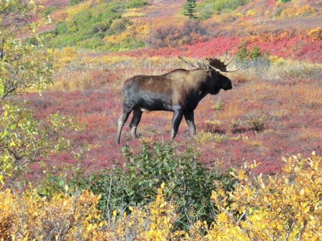
2:45 (85). big bull moose the north. just standing there. looks like the moose from Dalton. then again, all moose look alike to me. crowd of about 25 people gathering, including three kids closest to moose. stupid kids. stuoid parents. moose moves a little and then starts to buck, or whatever a moose does. not good. people start running in all directions. i cannot be sure, but did that moose just smile?
2:55 (86). someone just. pointed out to me that i left my camera on my hood. actually, it was my binoculars. why can't i follow my rules?
3:15 (92). Wonder Lake. at last. i have been trying to get here since 1992. magnificent. long break for dogs. again, leben in his wheelchair draws a lot of attention. but it takes time that i do not have to explain, but i stay polite. erde attracts attention too, but for her own reasons.
4:00 ready to move on back to camp. will postpone trip to Kintishna until Monday. as we were getting ready to move on, i heard this strange noise in the sky that went on for about 15 minutes. i looked up and saw a flock of many, many geese circling counter-clockwise in a huge circle. after the leader was assured that all had been accounted for, the flock headed south. first time i had seen that mustering of geese. i understand that at times, some are left behind. that's cruel mother nature.
5:00 (112) another break for dogs. Ellison center. dogs get more breaks today because of where we are. special treat.
5:50 (124) bear still there feeding on my way back. my guess is that he or she will be there for the next several days. lots of berries in this area. bears, by the way, don't pick the berries off the bushes like we dainty humans do; they eat the entire bushes.
7:00 (153) Arrived back in camp, four hours after i expected. later learned that just before we pulled in, a grizzly ambled through the camp nearby. probably looking for food, or Erde.
set up first fire of trip tonight. good for warmth and light. you do light fires here for atmosphere here as we do in DC.
Day 31, Free day
6:30 temperature was 20 when i got up.
First day of trip with absolutely nothing to do, all day. thank god i did not get lottery ticket for today. bad day to be out. heavy clouds, etc. talked with Edward Boudreau (photographer) for long time exchanging stories. he took photos of us next day with Denali in background. he also gave me a tour of his Jumping Jack tent/trailer. Some day i may have to upgrade to something like that.
Day 32, Second day of road permit.
6:00 cold again this morning. low last night was 18, 22 when i got up, but lots of sun, no clouds so temperature went up fast. but i put on Leben's coat to keep him warm. he has a harder time in the cold because the swimming he does back home takes away his body oils that keep him warm. lots of moisture in air so everything was frozen that was exposed to moisture, including tent. if day was not good, i was not going to travel Denali road today, but day was actually better....no clouds at all. how lucky i was to get the permit for two great days.
took down tarp shelter, but did not think ahead so it landed in fire. but it was so frozen, nothing burned. lucky me.
10:15 (153) again waited to give others a head start on the road. i can't take traffic jams well, although here that means 10 vehicles. but i welcome them because they tell me where the animals are. i would not be able to see them on my own driving.
11:30 (172) three Dall Sheep high on steep mountain cliff. how do they do that?
11:50 (182) same bear as yesterday. move up river a bit. totally ignoring us humans as he or she prepares for winter, which is coming soon.
11:55 (184) 12 Dall sheep way up high on steep cliff.
12:15 (188) break for dogs at magnificent overlook of Denali. Ed B. took photo of the three of us. some woman approached me and told me she had been trailing me for miles to get some great shots of Defender climbing steep hills, etc. she asked if she could follow me and i told her to go ahead, but i lost her. it seems that everyone is interested in the Defender after the other wildlife and Leben's wheelchair.
2:19 (219) Kantishna. i did not spend time here on tour of Quigleys' cabin because of my rule that if dogs cannot do it, i do not. took some photos. speak about remote living. there are also four lodges here for people who like their vacations to be really remote.
2:55 (229) back to wonder lake. great campground here. maybe someday. but no way to get the dogs out here since they are not a.lowed on the busses.
had a hard time figuring out how new red bas can works. they tried to mprove the design of these things since i last used one in 2001 but made it much more complex. i pity poor guy who needs to use one in an emergency. progress. for every step forward we tame, we actually move two back.
4:10 move on from wonder lake.
5.10 (249) vehicle speeding around blind turn on one of those treacherous cliff roads nearly ran me off steep cliff. he is supposed to stop for oncoming traffic because we are closer to cliff. probably some guy who got a late start today and is speeding his way through all 180 miles. maybe he'll add to body bag count, but not his own.
6:00 (270) flock of ptarmigan crossing road in front of me. must stop fr them, it's the law. why don't they fly over? that is the question we should ask.
6:05 (273) another moose. maybe this is why ptarmigan were crossing the road, to get away from this guy. looks like the same moose from Dalton.
didn't see the bear on the way back. maybe he/she has left for hibernation in the hills.
6:45 (296) Back at camp. cleaned Defender; discovered that my stove mysteriously disappeared from common storage during the day. need stove to make rice for erde. people next door loaned me theirs and gave me firewood. i never ceased to be amazed by kindness of strangers. (stove reappeared next day as mysteriously as it disappeared.). i liked loaner stove so much, decided to get one myself in Skagway, 1000 miles away, next opportunity i will have. (distance and time in this part of the world follow different rules of physics than back home. i look forward to 1000 mile legs of trips here, whereas in DC i try to avoid even 5-mile trips in the city. i can predict how long a 1000 leg will take me, whereas in DC i am off by hundreds of percents.)
9:00 discovered that i left tent light on whole day. but battery lasted and still good. also, when i went to take a photo of dogs sleeping, battery in camera died. lucky me that it did not happen on the road.
10:45 taps. cold. really cold already. i recall the words from a song from the fifties, "Meanwhile, back in the jungle," when the guy discovers he is being cooked. in a rapid, high voice he squeaks out something like, "Get me outta here!" well, get me outta here before the snows come.
Ed, from somewhere on the road
907-888-8693 cell
www.OTR6.com
The Dalton and the Arctic
This is the posting for Day 27, Tuesday, September 19th
Photos include
In 2000, Sonntag and I drove the entire 414-mike, dirt and gravel Dalton Highway all the way to Deadhorse, the small settlement at the end of the road in Prudhoe Bay. The milestones that have meaning to me along that route were created by that trip: our superb bivouac camp near Finger Mountain (MP 99), the Arctic Circle (MP 115), beautiful Grayling Lake (MP 150), an unbelievably gorgeous valley (MP 244), and the site of National Geographic photo of Sonntag and me camping in the snowstorm (MP 280), 24 miles north of temperamental Atigun Pass (MP 256). The following year, Leben and Erde took exactly the same trip up to Prudhoe Bay, camping in the same bivouac camps on the Dalton. The purpose of that trip was for me to scatter Sonntag's and Kessie's ashes at the MP 280 site with Leben and Erde in attendance. That year, we also drove the almost-500 mile dirt and gravel Dempster Highway in Canada, the only other road in North America that crosses the Arctic Circle. By the way, when you get to Prudhoe bay, you have to take a one mile bus ride to dip your feet into the arctic ocean. No thanks, I said both years I visited there.
The purpose of my current trip was to travel to the ends of the road in the northeast and northwest. We set out to do both in 2011, reached the former but had to turn back at Thunder Bay, Ontario, because of an overheating Defender and skin infection on Leben. We set out again after Leben's spinal surgery in 2012 to resume the trip, but again had to turn back at Thunder Bay when Leben became paralyzed. We lost exactly one month this year in getting started again due to snags reported here earlier, but once we got on the road by August 15 with Denali road permits starting September 13 and a decision to repeat the route on which we twice had to turn back, the goal was clear. I would be satisfied if we made it to the Arctic Circle, especially since there really is little of interet to see beyond Atigun Pass and the entire road itself is really of interest to me and not Leben and Erde, and certainly hard on the Defender and my nerves. So our goal this year was to make it to to Arctic Circle. If we did not use up our few spare days elsewhere along the long route, which we did at magnificent places like Riding Mountain, Johnson Canyon in Banff, and Boya Lake, or if we were willing to give up our Denali Pass for September 13, which I am glad we did not, we might spend this days driving up to Atigun Pass, but not beyond since the snows were already closing that treacherous pass.
The bottom line of all the above is that I was determined to make it to the Arctic Circle and we had just enough hours, minutes really, in our schedule to do that and still accomplish all else we set out to do. But we had to make it up and back to the Circle by dusk, a 400-mike round trip, to avoid driving on the Dalton after dark, which I did not want to do. Because of the limits on mikes per hour, we had to get on the road by 10 or the trip would have to be off or Denali cut short.
After Erde broke out of the tent in the morning to deal with her now-four-day gastro problem, I decided I had to take her to the vet. I stopped at the Aurora Animal Clinic and they had one appointment still open at that time. Dr. Pietsch examined Erde, ran some tests, and gave us some pills to deal with the problem. But it was now 11:00, so I had to decide whether to abort the trip or risk driving at night. I decided to go, and we gassed up and got on the road at noon, two hours late. To save time, I only filled my tank (15 gallons at not more than 15 mikes to the gallon) and my regular five gallon gas can, but not the new red one I had just bought the day before.
I'll let the mathematically endowed among my readers work out the mathematical puzzle I was faced with, providing only the facts I already gave above and these facts: the Dalton highway starts 80 miles from Fairbanks. The only gas stations north of Fairbanks are at 22 miles, and then on the Dalton at mileposts 56, 180, and then 414.
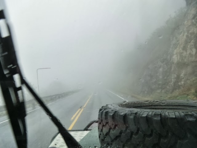
We got an early introduction to the risks of the Dalton shortly after getting on it. As we snaked our way along the guardrail-less steep dropoffs to the top of a rather beautiful summit, I noticed some low clouds up the roads. They weren't clouds but a wall of thick fog that allowed us perhaps 10-feet of visibility. Driving less than 15 miles an hour over the mike-long pass, we eventually broke out of the fog. From there to the Yukon River Crossing at 56 miles, the Dalton was just as beautiful as I recalled it from my prior two trips.
At 3:00 p.m., by the time I got to the gas station at the Yukon river, I had used up 150 of my no-more-than 225 mile tank, with an extra max75 mikes in my full spare fuel can. Since I could not make it the 120 mikes up and back to the Arctic Circle without using my spare can, I decided to fill up at the gas station both on the way up and back, so I pulled in. Well, as it turns out, some hunters had just left after emptying out the station's tanks for their boats on the Yukon. Here I was, 100 feet from the pipeline that supplies 15 percent of our oil and no gas? I thought about using the cache of tools and supplies I had with me to refine my own gas, but there was no Internet for me to learn how to do it on WikiHow. For the next 45 minutes, I was assured that the fuel truck was on the way, but each time I asked the estimated time of arrival got later. I had just driven 6600 miles only to find myself 60 miles away from my goal, 100 feet from the pipeline, but no gas. Even if I hsd filled up that red can, I would at some point in the day be faced with a similar dilemma.
I had three choices.
1- wait for the fuel truck to arrive, but if it got here later than 4:00 pm, I would have to give up my goal of the Arctic to avoid driving the Dalton in the dark.
2- head back to Fairbanks now, assuming the truck would not be here until after 4:00.
3-head up to the Circle now using the just-enough fuel I had for the 120 mile round trip in mt tank and spare gas can. But if the truck was not here when I it back, I would have to bivouac here at this crappy fuel stop to avoid night driving or if the truck never came, thereby ruining my chances if using my one of my two Denali road permits.
I took the risk that would get me to the Arctic and after emptying my spare can into my tank we headed up the Dalton. I gave up a rest stop at the Finger mountain bivouac site, in favor of pressing on the extra 14 miles to the Circle, which we made at 5:15. Just after pulling into the pull off, someone came up to me and handed me my gas cap, which I had failed to put back on after emptying the spare can no my tank. It had ridden the full bumpy 60 miles on my rear light, and only fell off when I made the turn into the circle when someone whom I had met at he gas station saw it. Lucky me.
At 6:00, After a few obligatory photos, proof that we had been there, but duplicates of the same photos from 2001, we all loaded into the Defender and head back to the Yukon River to fuel up, if the truck had come, and thn head back to Fairbanks. No more than four miles up te road, my eye caught a large brown image moving steadily with us to my right. As I glanced to my right to see if was one of those illusions one has on these empty roads, the brown blur, a huge bull moose, dashed right in front of the Defender. Fortunately, he was on the other side of he road before I had a chance to break, but not before I had a chance to grab my camera and git a shot of him fleeing.
On the way past Finger Mountsin, I paused for a few photos, perhaps as reminders of the lone wolf we encountered here during our visit in 2001, or maybe of Leben's eating the fox tail flower there, the result being the barb-laced angel-hair like flower getting caught in his throat until a dollop of penut butter dragged it into his stomach.
We pulled into the gas station at 7:15 and my risk paid off. Pat, the fuel truck driver, was just securing his hose. When I inquired about the fog down the line, he said he encountered none, but that it's coming. With that, i fueled, jumped into he Defender, got out to check the gas tank cap, and got underway.
The drive back to Fairbanks was uneventful, but stressful as we had to navigate the Dalton in the dark. It is an entirely different road at night, The worst is when you encounter a truck coming in the opposite direction when the headlights at your eye level prevent you from seeing anything ahead if you, eg, the road, a cliff, a moose, etc.
At 11:00, we pulled into our camp in Fairbanks. I was thrilled we had made our goal, but even happier that we did not plan to go farther up the Dalton for reasons related to the dogs, the Defender, and me.
Start of dalton
Leben and Erde at the circle
The moose on the dalton
Finger mountain area
Days33-35, Monday-Wednesday, September 16-18, Denali to Skagway via Tangle Lake camp Alaska and a rest stop in the Yukon
I already wrote a posting about our drive down the 120 miles dirt and gravel Denali Highway, which is not the Denali Park Road, which I still owe a posting on. There is no doubt, this is probably one of the most scenic roads anywhere, especially in the fall, but one has to weigh that against the terrible condition of the road. Not a moment on the road is without some fantastic visa, the one photo I hope to attach s a small sample. By the way, I took the photo with my ipad and in the process of climbing back down the steep, rocky slope on which I took the photo I slipped and fell. My main concern was protecting the ipad with all my photos, but avoid injury myself. The photo depicts the Alaskan Mountain range.
I learned on my way out of the highway the next day that all the hunters I saw in their camps along the road, with their ATVs all gassed up and ready to go,care laying in wait for the Nalchina caribou herd. I was trying to figure out some way to warn the herd, but decided to move on. I reasoned that those hunters have guns, but inonlybhave bear spray.
In the process of moving on, I almost hit another stray dog, 12 miles in one direction from any settlement, and 20 in another. Fortunately, he or she escaped unscathed into the brush. My hope is that it wasn't a stray but a wanderer.
I camped at a pleasant state park called Tangle Lake, although the wind was a little too much for me in trying to set up my new tent. (It is a three-person tent, which means it takes three people to set it up.) On Tuesday morning it started to snow and so I made haste to get out of there. Eighteen inches were expected.
My plan for Tuesday was to drive at least half the 730 mile trip to Skagway so I could spend some time in Skagway before my midnight ferry to night, Wednesday That would put me near Destruction Bay, Yukon, on the ALCAN, where I camped once before. But I did not want to be on the ALCAN, an extremely empty road during the day, at night, especially with the risks of driving that road. Charging my satellite phone again just in case, our trip followed the contours of the awesome Elias Wrangell mountains, and again I was treated to a magnificent experience, despite the low clouds. But on the ALCAN, I had to come to a screeching halt three times to avoid hitting a deer, a moose, and a little creature that looked like a cross between a mongoose and squirrel.
Although it was getting past dusk, I pushed on to make Destruction Bay just as usuable daylight was disappearing, but also just as the cold and very high winds set in. I was not particularly looking forward to setting up camp in those conditions. Fortunately, I fed Leben and Erde at a rest stop earlier on the ALCAN, so that chore was out of the way. After experiencing the thrills of the ALCAN that resembled a broken roller coaster, when I got to cold, windy Destruction Bay, I was told that all the campsites in the area were closed to tenters because of the high bear presence. So, tired and not thrilled about driving the ALCAN alone in the dark, I decided to push on to the next Yukon camp, 60 miles on. Half way there, I lost one of my headlights. Although I have a spare with me, I was not about to stop to change it, so I drove on using my brights, which you do not want to use anywhere where there is opposing traffic, especially on the ALCAN with its narrow shoulders and steep drop offs.
After an hour of very slow driving, when I came to the Spruce Beetle rest stop just before Haines, I decided to call it quits. Instead of pitching my tent, I decided to sleep in the Defender, sitting up in the driver's seat since all other space is already occupied by he dogs. What a mistake, even though I had my sleeping bag to help ward off the freezing temperature. Most of my night was spent trying to figure out which body part I could move where to maximize the comfort and minimize the pain of sleeping in an already cramped seat, as well as trying to maneuver portions of my sleeping bag to block the Defender's many entrances for cold air. Several times I turned on the engine to get the heater working, knowing - or not caring - that asphyxiation is not a risk in the well-ventilated Defender, but the quirky heater works only when it wants to and not when I want to. (Nice, huh? In Alaska in their winter.) And when I did finally mange to get some shut-eye, Erde starting to run in her sleep as she is wont to do, banging her paws into everything that makes noise in the former front passenger seat. The list goes on and on, but I did manage to get three hours of well-earned sleep and several occasions of dramatic night skies, as the clouds lifted, the stars came out, and the full moon jumped out from behind the clouds, reflecting on the bay the road bordered. I thought for a moment that maybe all I went through to get there was worth it, but I am not ready to say that yet.
The drive down the ALCAN to Whitehorse along the edge of the Wrangell mountains was impressive, as was the drive down the South Klondike Highway to Skagway. But as I neared Skagway, climbing the same mountains the Klondikers climber a century so, thinking that all the adventure (read risk) was behind me, WHAM, I ran into a wall of heavy fig that lasted for 10 miles on an already treacherous mountain road. I found myself cursing the Klondikers, saying that I wished they had pursued their dreams of getting rich by pushing AMWAY goods or selling Florida swamp land instead of hustling for gold. After getting a grip on myself, I reached the bottom of the same mountains the Klondikers climbed (in less luxury, of course) and paid a visit to the cemetery holding the graves of several dozen Klondikers killed in the April 3, 1898 avalanche here. Leben and Erde also paid their respects for the second time, the first time being in 2001 when they were pups.
So, here we sit in the one-hesd-light Defender waiting for the ferry and the real start to our trip home. Leben and Erde are going to have to remain in the Defender for the four days, but I'll be able to walk them at the ports. But since my rule is to treat them like I treat myself, I'll hang out on the deck instead of getting a state room for myself. And since I'll be cutting back on their meals for the next few days for an obvious reason, I'll lose another pound or two myself.
There may not be internet on the ferry, so I may not blog four several days, but I will write up the most important posts of this trip I still owe. And maybe I'll even try to get past page 11 in the first of a dozen books I brought along.
Photos include...
The Alaskan range from the terrible Denali Highway
Dinner is served at a rest stop on the lonely ALCAN
Erde finally shows an interest in the views and not smells
The wall of fog for 10 miles going into Skagway
Leben and Erde pay their respects at the Slide Cemetery
907-888-8693 cell
Day 35, The Trip So Far, Skagway, Alaska
When we reached Skagway today, we hit 8270 miles for the outward bound leg of this part 2 of our journey across the top of North America.
The map below tracks our current journey, parts 1 and 2, as well as the other portions of Leben and Erde's prior journeys.
Part 1 (the green line) of our journey (in 2011) was to the end of the road in the northeast, to a place called Northwest River, Labrador. Leben and Erde also visited there in 2002, as well as all the other eastern Canadian provinces and US states to get there and back. The red line shoes those other provinces.
Part 2 (the black line) is the outward bound part of he journey we are now on, which has been completed precisely as planned, despite the pesky problems reported here earlier. The blue line shows the homeward bound journey, which we are now on. I jumped ahead a bit and added the ferry route we taking from Skagway Alaska to Vancouver Island BC (the blue line with hash marks).
Leben and Erde's prior journey up the Dempster Highway in Canada and Dalton Highway to Prudhoe Bay Alaska are shown in red in the northwest. They did both in 2001. Of course, the current journey, parts 1 and 2 duplicated a lot of their prior journeys in 2001 and 2002, but they were different dogs then with different interest.
The return trips from the prior journeys are not shown..
The map below tracks our current journey, parts 1 and 2, as well as the other portions of Leben and Erde's prior journeys.
Part 1 (the green line) of our journey (in 2011) was to the end of the road in the northeast, to a place called Northwest River, Labrador. Leben and Erde also visited there in 2002, as well as all the other eastern Canadian provinces and US states to get there and back. The red line shoes those other provinces.
Part 2 (the black line) is the outward bound part of he journey we are now on, which has been completed precisely as planned, despite the pesky problems reported here earlier. The blue line shows the homeward bound journey, which we are now on. I jumped ahead a bit and added the ferry route we taking from Skagway Alaska to Vancouver Island BC (the blue line with hash marks).
Leben and Erde's prior journey up the Dempster Highway in Canada and Dalton Highway to Prudhoe Bay Alaska are shown in red in the northwest. They did both in 2001. Of course, the current journey, parts 1 and 2 duplicated a lot of their prior journeys in 2001 and 2002, but they were different dogs then with different interest.
The return trips from the prior journeys are not shown..
Day 35, 18 September, Haines Junction, ALCAN, Yukon, As It Is Happening
Just stopped for coffee in Haines Junction On the way to catch the ferry to Prince Rupert and then Vancouver Island. Had a terrible, terrible night last night. Worst of my entire trip, maybe my entire life. More on that in my regular posting. I'll have lots of time on the four day ferry to blog, etc. Poor dogs have to say in the Defender.
Day 34, as it is happening, Richardson Highway and Tok Cut Off intersection
Col this morning and snow. They say a foot and a half by tomorrow. I'm getting out if here fast. Just enough gas to make it to next station miles and miles up the road.
Just had the most delicious salmon sandwich here (see photo). You can't miss the place, and I mean it. If you ever pass through here you have to try it. Freshly caught in the nearby stream. Leben and Erde get a dog biscuit.
Snow, rain and fog today. I just might go until I feel tired and then sleep in the Defender to save time that we can spend in Skagway tomorrow. Leben and Erde were there in 2001 and enjoyed themselves thoroughly, all at my expense.
My regular posting for today will follow later.
Just had the most delicious salmon sandwich here (see photo). You can't miss the place, and I mean it. If you ever pass through here you have to try it. Freshly caught in the nearby stream. Leben and Erde get a dog biscuit.
Snow, rain and fog today. I just might go until I feel tired and then sleep in the Defender to save time that we can spend in Skagway tomorrow. Leben and Erde were there in 2001 and enjoyed themselves thoroughly, all at my expense.
My regular posting for today will follow later.
Day 33, September 16, Denali to Tangle Lake Park on the Denali Highway
As I wrote earlier today, the return trip promises to be just as exciting as the outward bound trip, and based on this first day's experience, that is turning out to be the case.
After leaving Teklanika Camp, we drive the 30 miles to the park entrance along the park road. The views going back were more extraordinary than when we came, as often happens on return trips when you get to see quite a different version of what you saw going the other way. After gassing up, we set off for the 120 mile, dirt and gravel Denali Highway, 20 miles to the south.
I distinctly recall driving the Denali Highway in 2001 with Leben and Erde. But it was raining the whole day and we saw no scenery. The road was terrible, I recall, and that's after we had just driven the Dempster Highway and Dalton Highway. We spent the wet night in what resembled a gravel pit camp toward the end of the road at Paxson. All three of those memories have no been replaced with three radically different ones.
First of all, we had a clear day of driving this time. There was not a moment during the four-hour drive when I was not in awe of what I was looking at. I just wish that someone else was driving. To the north, perhaps 15 miles distant across a valley, or plain, of evergreens and lush fall colors the Alaska range unfurled itself for the full distance. I was almost in a state of shock the scenes were so awesome. How right I was to give this road a second chance. Without a doubt, it is among the top three roads I have traveled for its beauty.
As for the road, if it was terrible 12 years ago, today, until McClaren Summit, 100 miles along the road, it is by far the worst road I have ever driven. I almost want to say I regret driving it, but since we all made it off tbe road safely, will not. The road resembles a washboard, riddled with so many potholes that every piece of my Defender got a through workout. You cannot see s the potholes coming as they blend not the road. When it come upon them, usually continuously, it is impossible to avoid hitting them. If you have a short wheel are like I do, when you hit the potholes going rest than 25, your vehicle will surely emerge from the holes at a radically different vector than going in. I had to drive the road with two hands tight on the steering wheel. Of you lose control of the vehicle emerging from the potholes, you had better be in the center of the road. Fortunately, the road was empty of vehicle the while 120 miles,,except for the hundreds of vehicles with their ATVs parked along the way, waiting for the caribou herd to come through. Of course, an empty 120-mile road is not what you want if your vehicle breaks down, so on the fly i made sure my satellite phone was fully charged. Better safe than sorry.
Fortunately, I did not need the sat phone and the Defender performed admirably. At 7:30, after one break fkr ghe dogs during the drive, we pulled not Tangle Lake Camp. If this is the same place I stayed in in 2001, and it has to be, I was so wrong about it. It's a windy open area overlooking a lake with a lot of wind. The sunset was gorgeous, as my photo shows. By the way, my camera's battery was recharging today so I could not take any photos but this one. If I took them at the same rate as i took on the other roads, I'd still be on the road, so I guess that's a good tradeoff.
For the first time on this trip, I had to accept someone's kind offer to help me set up the tent. There's one chore in setting up this new NorthFace tent of mine that is impossible to do alone in the wind. Patrick Hallihan of Homer Alaska, who was here with his family, saw me struggling and came by to offer help, which I quickly accepted. Patrick and his family get the prize for being the hardiest campers by far I have encountered on this trip.
I have two days to drive 800 miles to Skagway to catch the ferry that will eventually drop us off at Vancouver Island. I hope that those drives are uneventful, but they never seem to be.
Sunset at Our Tangle Lake as i set up our camp.
Ed, from somewhere on the road
907-888-8693 cell
www.OTR6.com
since August 15
Day 33, Monday, September 16, DENALI, 7260 miles (for part 2 of our journey)
I am sending this as I leave Denali Park. It will take me hours to write up our experience, so let me just say one thing about it and send one photo.
To say that what we just experienced, over two glorious days, was a once-in-a-lifetime experience would grossly understate what the experience was all about. My vocabulary is too limited to do justice to it, but I will try later, on the ships to Vancouver. I took close to 500 photos, mostly while driving over a sometimes treacherous road, of which I will share many on my blog later. Since this was Leben and Erde' trip, the one photo I will share now is of them (by John Bodreau of Anchorage). That's Denali in back of us.
We accomplished two of the three goals for this trip, the Arctic and Denali, also accomplishing our earlier goal of traveling to the ends of the road in the north,camping out all the way, more than 15,000 miles so far. I could not imagine two better companions for this trip than Leben and Erde. Now, we have only one goal left, to get home safely. If my past road trips are any indication, the return trip promises to be just as exciting as the outward bound trip. But if it is anything, I hope it is warmer than Denali. This morning, the low was 18 degrees, but 10 degrees warmer in the tent. It was a three-dog night, if you count me.
To say that what we just experienced, over two glorious days, was a once-in-a-lifetime experience would grossly understate what the experience was all about. My vocabulary is too limited to do justice to it, but I will try later, on the ships to Vancouver. I took close to 500 photos, mostly while driving over a sometimes treacherous road, of which I will share many on my blog later. Since this was Leben and Erde' trip, the one photo I will share now is of them (by John Bodreau of Anchorage). That's Denali in back of us.
We accomplished two of the three goals for this trip, the Arctic and Denali, also accomplishing our earlier goal of traveling to the ends of the road in the north,camping out all the way, more than 15,000 miles so far. I could not imagine two better companions for this trip than Leben and Erde. Now, we have only one goal left, to get home safely. If my past road trips are any indication, the return trip promises to be just as exciting as the outward bound trip. But if it is anything, I hope it is warmer than Denali. This morning, the low was 18 degrees, but 10 degrees warmer in the tent. It was a three-dog night, if you count me.
Day 33, Monday, September 16, Denali National Park, HOMEWARD BOUND after 7250 (15,250 with part 1)
After 7,250 miles of traveling and camping out every night, experiencing some of the world's most splendid natural creations, meeting incredibly good people (with one notable exception), encountering and then solving the unpredictable and inevitable problems that crop up on these trips, as we drive out of Denali Park the Outward Bound leg of this journey, part 2 of our "frigid sea to frigid sea journey" has come to and end. And what a journey it was! It was my, I mean Leben and Erde's, journey, but I must say that even I am impressed. Cold, but impressed nonetheless. I have found no evidence that anyone else has ever made this journey, especially as we did it. At least no one in his or her right mind.
The track of our journey since August 15 is shown below (top) in black. Part 1 of this journey is shown in green. The "been there, done that" pieces are shown in red, i.e. the Dalton Highway (to Prudhoe Bay, Alaska) and Dempster Highway (to Inuvik, Northwest Territory, Canada) pieces in the northwest in 2001 and the Newfoundland, Nova Scotia and Prince Edward Island, etc. pieces in 2002. Homeward portions of prior trips are not included.
The perceptive among my readers are probably saying, "But, Ed, you still have to get home," and you would be right. This journey isn't over until the four of us, Leben, Erde, the Defender, and I are all safely back home. If the past is prologue, the return trip promises to be as exciting as the outward bound portion, if not more so, so continue to check in here for updates. The bottom map shows the only portion of the homeward bound trip currently planned so far: the black line shows the three-day drive we have ahead of us from Denali to Skagway, where we have to catch the ferry by 2:30 a.m. September 19th. The blue line shows the four-day journey by sea, first from Skagway to Prince Rupert BC,and then from there to Port Hardy on Vancouver Island BC. I have no idea at this time where we will go from there to reach our destination, Washington, DC, the orange dot on the other side of the continent. If any reader of this blog would like to guess the route we will take, draw a map with your guess and send it to ed.otr6@gmail.com along with photos of two box tops from any large box of instant white rice (which turned out to be Leben and Erde's favorite food on this trip) and the person who comes closest will be eligible for a prize yet to be determined. Entries must be postmarked by September 23 to be eligible. (It would be appreciated if you would send the rice by USPS, etc. later.)
The track of our journey since August 15 is shown below (top) in black. Part 1 of this journey is shown in green. The "been there, done that" pieces are shown in red, i.e. the Dalton Highway (to Prudhoe Bay, Alaska) and Dempster Highway (to Inuvik, Northwest Territory, Canada) pieces in the northwest in 2001 and the Newfoundland, Nova Scotia and Prince Edward Island, etc. pieces in 2002. Homeward portions of prior trips are not included.
The perceptive among my readers are probably saying, "But, Ed, you still have to get home," and you would be right. This journey isn't over until the four of us, Leben, Erde, the Defender, and I are all safely back home. If the past is prologue, the return trip promises to be as exciting as the outward bound portion, if not more so, so continue to check in here for updates. The bottom map shows the only portion of the homeward bound trip currently planned so far: the black line shows the three-day drive we have ahead of us from Denali to Skagway, where we have to catch the ferry by 2:30 a.m. September 19th. The blue line shows the four-day journey by sea, first from Skagway to Prince Rupert BC,and then from there to Port Hardy on Vancouver Island BC. I have no idea at this time where we will go from there to reach our destination, Washington, DC, the orange dot on the other side of the continent. If any reader of this blog would like to guess the route we will take, draw a map with your guess and send it to ed.otr6@gmail.com along with photos of two box tops from any large box of instant white rice (which turned out to be Leben and Erde's favorite food on this trip) and the person who comes closest will be eligible for a prize yet to be determined. Entries must be postmarked by September 23 to be eligible. (It would be appreciated if you would send the rice by USPS, etc. later.)
Subscribe to:
Posts (Atom)